


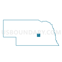
Elba Precinct, Howard County, Nebraska
About
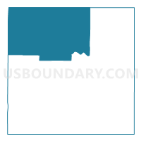
Outline

Summary
| Unique Area Identifier | 613278 |
| Name | Elba Precinct |
| County | Howard County |
| State | Nebraska |
| Area (square miles) | 143.38 |
| Land Area (square miles) | 142.01 |
| Water Area (square miles) | 1.37 |
| % of Land Area | 99.04 |
| % of Water Area | 0.96 |
| Latitude of the Internal Point | 41.33055700 |
| Longtitude of the Internal Point | -98.59946170 |
Maps

Graphs
Select a template below for downloading or customizing gragh for Elba Precinct, Howard County, Nebraska


Neighbors
Neighoring Voting District (by Name) Neighboring Voting District on the Map
- Ashton Precinct, Sherman County, NE
- Posen Precinct, Howard County, NE
- Scotia Voting Precinct, Greeley County, NE
- Spring Creek Precinct, Howard County, NE
- St. Paul Ward 2, Howard County, NE
- Wolbach 2 Voting Precinct, Greeley County, NE
Top 10 Neighboring County Subdivision (by Population) Neighboring County Subdivision on the Map
- Scotia precinct, Greeley County, NE (555)
- St. Paul precinct, Howard County, NE (539)
- Ashton precinct, Sherman County, NE (434)
- Wolbach precinct, Greeley County, NE (423)
- Posen precinct, Howard County, NE (289)
- Elba precinct, Howard County, NE (279)
- Fairdale-Logan precinct, Howard County, NE (192)
- Cotesfield precinct, Howard County, NE (123)
- Warsaw precinct, Howard County, NE (94)
- Dannevirke precinct, Howard County, NE (71)
Top 10 Neighboring Place (by Population) Neighboring Place on the Map
Top 10 Neighboring Unified School District (by Population) Neighboring Unified School District on the Map
- St. Paul Public Schools, NE (3,613)
- Loup City Public Schools, NE (2,220)
- Greeley-Wolbach Public Schools, NE (1,153)
- North Loup Scotia Public Schools, NE (1,120)
- Elba Public Schools, NE (490)
Top 10 Neighboring State Legislative District Upper Chamber (by Population) Neighboring State Legislative District Upper Chamber on the Map
Top 10 Neighboring 111th Congressional District (by Population) Neighboring 111th Congressional District on the Map
Top 10 Neighboring Census Tract (by Population) Neighboring Census Tract on the Map
- Census Tract 9706, Howard County, NE (4,580)
- Census Tract 9701, Sherman County, NE (3,152)
- Census Tract 9709, Greeley County, NE (2,538)
- Census Tract 9705, Howard County, NE (1,694)